Summary
Editor's rating
Value for money: good tool if you really need it, pricey if you’re casual
Chunky, practical, and clearly built for rough handling
Battery life: honest 15–20 hours if you’re not abusing the backlight
Ruggedness and water resistance: built to be abused, with a few caveats
Positioning, tracking, and navigation: solid, but maps hold it back
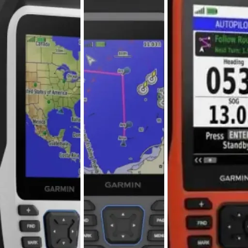
What you actually get with the GPSMAP 79s
Pros
- Rugged, floating design that actually holds up to spray, drops, and general abuse
- Accurate GPS with support for multiple satellite constellations and a reliable 3‑axis compass
- Runs on AA batteries with realistic 15–20 hours of use and easy refueling with spares
Cons
- Very basic base maps; serious use basically requires buying extra charts
- Dated button‑based interface and text‑heavy menus compared to modern devices
Specifications
View full product page →| Brand | Garmin |
A handheld GPS for when you really don’t want to fall back on your phone
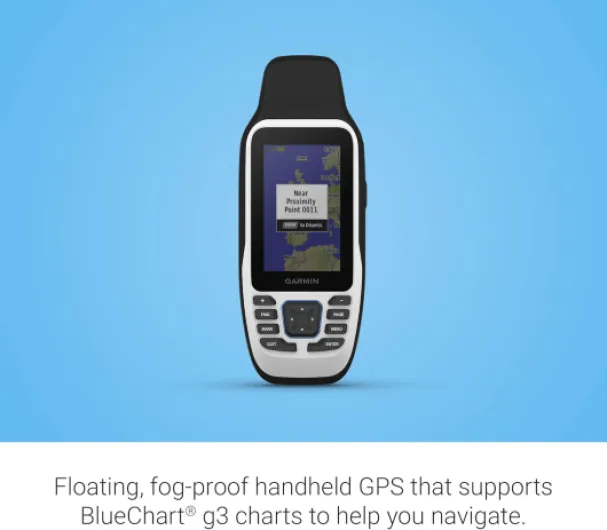
I’ve been using the Garmin GPSMAP 79s for a few weeks on a small fishing boat and a kayak, mainly as a backup to the plotter and my phone. I went for this one because I wanted something that floats, doesn’t care about spray, and doesn’t die the second it gets cold or wet. On paper, it ticks all those boxes: IPX6 water resistance, it floats, 20 hours of battery, and it runs on simple AA batteries.
In real life, it feels like a very typical Garmin handheld: a bit old‑school, very button‑driven, and clearly made more for reliability than for style. If you’ve used older GPSMAP devices, you’ll feel at home in about 10 minutes. If you’re used to smartphone apps, you’ll probably swear a bit at the interface at first, but you’ll also see the benefit the first time your phone is soaked and useless.
The big thing to understand is this: out of the box, the mapping is basic. The “worldwide basemap” is more like a rough sketch than a proper marine chart. As a pure position and track recorder, though, it’s solid. Satellite lock is quick, even under a bimini or in the car, and it keeps a stable track even when I’m moving slowly while jigging.
So far, I’d sum it up like this: it’s not flashy, it’s not cheap, but it feels like a reliable tool. The more time you spend on the water and the less you trust your phone, the more this thing starts to make sense. If you want something plug‑and‑play with detailed charts right away, you’ll probably be a bit disappointed unless you’re ready to buy extra maps.
Value for money: good tool if you really need it, pricey if you’re casual
On the money side, the GPSMAP 79s sits in that slightly awkward zone: not cheap, especially once you add proper marine charts, but clearly more capable and tougher than budget handheld GPS units. If you just look at it as a basic GPS with a rough basemap, the price feels a bit high. Where it starts to make sense is if you factor in the rugged build, the floating design, and the fact that it’s a true marine‑oriented device and not just a hiking GPS repurposed for boats.
Compared to using a smartphone with a marine navigation app, the phone is obviously cheaper and more user‑friendly in terms of interface and map detail. But after a couple of outings with wet conditions, glare issues, and a drained phone battery, I was glad to have the 79s as a separate, dedicated tool. It doesn’t care about spray, it’s readable in bright sun, and if it goes overboard, it floats. A phone doesn’t check any of those boxes unless you spend more money on cases and mounts.
Where the value drops a bit, in my opinion, is the mapping. The included basemap is too basic for serious navigation. If you want the full experience (depth contours, navigation aids, etc.), you basically have to buy a Garmin BlueChart or similar map card, which isn’t cheap. So the real cost is: device + maps + batteries (or rechargeables). At that point, you’re in the same ballpark as some small fixed plotters, except those need power and installation.
So, who gets good value here? Someone who: spends real time on the water, wants a reliable backup to the main instruments, or uses small craft (kayak, dinghy, rental boats) without built‑in electronics. For a casual weekend boater who stays near shore and already uses a phone app, this might feel like overkill. I’d rate the value as decent, but not mind‑blowing; it pays off if you actually use the ruggedness and standalone nature, otherwise it’s just an expensive backup gadget.
Chunky, practical, and clearly built for rough handling
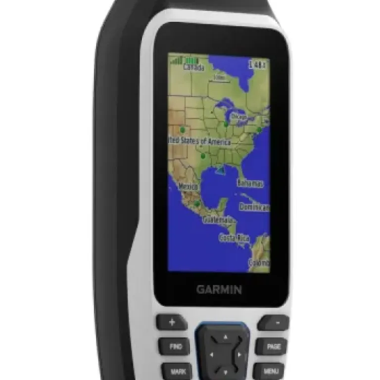
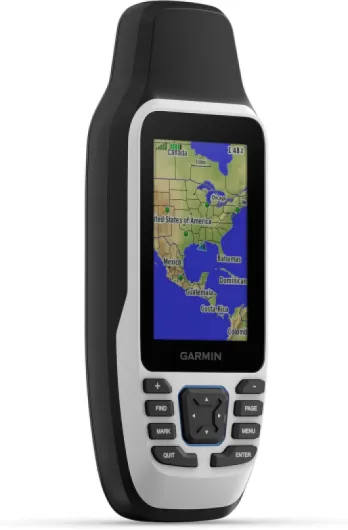
Design‑wise, the GPSMAP 79s is more “tool” than “gadget”. It’s tall and a bit thick, with big rubberized sides and pronounced buttons you can actually press with wet fingers. It’s not pretty, but on a rocking boat with cold hands, I’m glad it’s like that. The screen is 3 inches with a 240 x 400 resolution. On paper that sounds low compared to phones, but because it’s a transflective display, it’s very readable in direct sun. Out on the water at noon, it’s actually easier to read than my phone.
The buttons are all on the front: power, zoom in/out, menu, page, mark, and a directional pad with an OK button. After a couple of outings, I was navigating the menus without looking too much, which is nice when you’re trying not to fall overboard. The interface is old‑school Garmin: lots of text menus, not very pretty, but once you set up your main screens (map, compass, trip data), you don’t need to dive into the settings constantly.
One detail I liked: the lanyard attachment point is solid, and the included lanyard is basic but usable. I ended up clipping it with a carabiner to my PFD so if it slips, it’s not going anywhere. I did drop it in the water once near the dock on purpose to test: it floats, screen up, so you can spot it easily. That’s a big plus, especially if you’re in a small boat or kayak where things tend to go overboard.
On the downside, it’s not small. If you’re used to pocket‑sized hiking GPS units, this will feel a bit bulky in a jacket pocket. Also, there’s no touchscreen here; everything is via buttons. Personally, I prefer that on the water because touchscreens with wet hands are a pain, but if you’re expecting phone‑like interaction, you’ll be disappointed. Overall, I’d say the design is functional and boat‑friendly, but definitely dated if you look at it next to modern electronics.
Battery life: honest 15–20 hours if you’re not abusing the backlight
The battery side is pretty straightforward: it runs on two AA batteries, which are not included. Garmin claims up to 20 hours in GPS mode. In my use, with mixed backlight levels and on for most of a long day on the water, I’ve been getting around 14–18 hours on decent NiMH rechargeables (Eneloop style). With fresh alkalines, it was close to that too, maybe a bit more, but I don’t like relying on disposables.
The good thing with AA batteries is obvious: if you’re on a multi‑day trip, you just bring spares. No hunting for a USB port or power bank. I keep two spare pairs in a dry bag and I’m calm. The downside is cost over time if you only use disposables; if you’re going to use this a lot, just buy good rechargeables and a charger, it pays for itself. Also, in cold weather, alkalines tank faster, while decent NiMH cells handle it better.
The screen backlight is what really eats power. If you leave it on max brightness all the time, you’ll see the battery indicator drop faster. In bright daylight, you actually don’t need much backlight because the transflective screen uses ambient light, so I usually keep it low or off. At dusk or night, you’ll have to crank it up, and that’s when you’ll be closer to the lower end of the battery life range.
Charging wise, there is no internal charging for AA cells via USB; the USB port is for data only. So don’t expect to plug the unit into a power bank and charge your batteries inside. If you want continuous operation on a bigger boat, the better move is to either keep a pile of AAs or use an external AA charger powered by the boat’s 12V. Overall, I’d say battery life is decent and predictable, and the AA format makes it practical for real outdoor use, even if it’s not as convenient as a built‑in rechargeable for some people.
Ruggedness and water resistance: built to be abused, with a few caveats
Durability is one of the main reasons I picked this thing, and on that front, it feels reassuring. The casing is thick plastic with rubberized sides, and it’s rated IPX6. That means it handles heavy splashes and rain, and in practice I’ve had it constantly sprayed in choppy conditions with zero issues. I’ve also used it in light drizzle for a couple of hours—no fogging under the screen, no weird behavior.
I did a few unscientific drop tests: from about 1.5 m onto a wooden deck and once onto a concrete dock (not on purpose that time). Result: a small scuff on the plastic corner, but everything still works. The glass is advertised as scratch‑resistant and fogproof. I can’t speak to long‑term micro‑scratches yet, but after being in a bag with keys and some metal tools, no visible damage so far. It’s definitely tougher than a phone screen without a protector.
The floating part is also real. I tossed it into the water near the dock (with the lanyard attached, just in case) and it popped up quickly, floating screen‑up. That’s a big deal for a marine device. Just keep in mind: IPX6 is not the same as full submersion rating. It handled a quick dunk just fine, but I wouldn’t leave it underwater for minutes and expect zero risk. It’s made to survive accidents, not to be a dive computer.
Long‑term, the only things I’d keep an eye on are: the rubber covers over the USB port and microSD slot (these tend to get loose on older units) and the buttons. On older Garmin handhelds I’ve used, the rubber over the buttons can get shiny and softer after years in the sun, but that’s after serious abuse. Overall, I’d call the 79s tough and well adapted to a harsh marine environment, much more so than any phone or cheap generic GPS I’ve tried.
Positioning, tracking, and navigation: solid, but maps hold it back
In terms of pure GPS performance, the 79s is pretty solid. It locks onto satellites in under a minute from cold start for me, often faster, even when I’m under a canvas top or inside a car. Once it has a fix, I haven’t seen it drop out, even when close to cliffs or in a marina with masts around. The multiple satellite constellations clearly help; the position cursor doesn’t jump all over the place like cheaper handhelds I’ve used.
Tracking is where it shines. I’ve used it to record full outings of 4–5 hours, and the track looks clean when I check it later on the map—no crazy zigzags. When trolling slowly or drifting while jigging, speed over ground and heading stay stable enough to be useful. The built‑in 3‑axis compass is handy when you’re stopped or moving very slowly; your heading doesn’t spin randomly like on GPS‑only devices. You do need to calibrate it properly once in a while, but that only takes a minute.
The weak point is the base mapping. The worldwide basemap is basically just coastline and big features. For serious navigation, you really need proper charts. Once I loaded a Garmin map card (borrowed from a friend), the experience changed completely: depth contours, buoys, and more detailed shorelines made the device way more useful. Without that, I mainly use it to mark waypoints, follow my own tracks, and check distance/bearing, not as a primary chart.
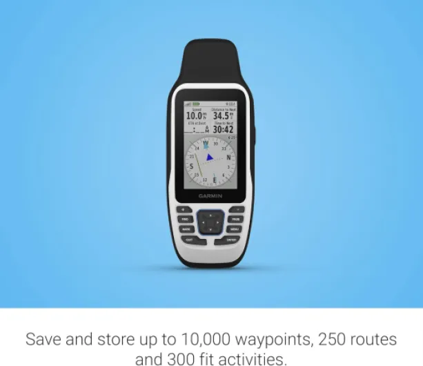
Route and waypoint management is classic Garmin: powerful but slightly clunky. You can store up to 10,000 waypoints and 250 routes, which is plenty, but naming things with the buttons is slow. It’s much easier to connect it to a PC and manage waypoints/routes with Garmin software, then sync. For someone who likes to pre‑plan fishing spots or anchorages, that’s the way to go. Overall, I’d rate the performance as reliable and accurate, but the out‑of‑the‑box navigation experience is limited by the basic maps unless you invest in extra charts.
What you actually get with the GPSMAP 79s
Out of the box, the Garmin GPSMAP 79s is pretty barebones: the unit, a lanyard, a USB cable, and the usual papers. No batteries, no mount, no case. So right away, plan on buying a couple of AA batteries (ideally rechargeables) if you don’t already have a stash. The device itself weighs around 280 g and feels like a solid plastic brick in the hand—reassuring for durability, less so if you want something super compact.
Function‑wise, it’s a handheld marine GPS with a 3" color screen, 8 GB of internal memory, and a microSD slot for extra maps. It supports a bunch of satellite constellations (GPS, GLONASS, Galileo, Beidou, QZSS, SBAS), which in practice just means it gets a fix fast and keeps it even when conditions aren’t ideal. It can store up to 10,000 waypoints and 250 routes, which is more than enough for most people. I’ve only logged a few dozen spots so far—reefs, mooring points, and some trails—and I’m nowhere near the limit.
By default, it comes with a worldwide basemap plus a basic North America map, but we’re talking outline level: coasts, big lakes, major roads, some basic info. If you want detailed bathymetry or real marine charts, you need to add Garmin BlueChart or other compatible maps on microSD. That’s where the real cost creeps up: the unit + map card starts to look less cheap, especially if you compare it to just using a phone app with a cheap subscription.
In daily use, I’ve mostly used it to: mark fishing spots, follow tracks back to the dock when visibility drops, and check speed over ground and heading. For that kind of use, it does the job very well. It’s clearly not meant to replace a full chartplotter on a bigger boat, but as a backup or for small craft (kayak, dinghy, rental boat), it fits the role. Just don’t expect miracles from the base maps or smartphone‑level graphics, because that’s not what this is.
Pros
- Rugged, floating design that actually holds up to spray, drops, and general abuse
- Accurate GPS with support for multiple satellite constellations and a reliable 3‑axis compass
- Runs on AA batteries with realistic 15–20 hours of use and easy refueling with spares
Cons
- Very basic base maps; serious use basically requires buying extra charts
- Dated button‑based interface and text‑heavy menus compared to modern devices
Conclusion
Editor's rating
Overall, the Garmin GPSMAP 79s is a solid, no‑nonsense handheld for people who really spend time on the water and want something tougher and more reliable than a phone. The positioning is accurate, the track recording is clean, the compass and barometric altimeter are useful extras, and the device clearly handles spray, drops, and general abuse better than most electronics. The fact that it floats and runs on AA batteries makes it practical for small boats, kayaks, and as a backup on bigger vessels.
It’s not perfect though. The interface feels dated, the base maps are very basic, and to really use it as a primary navigation device, you basically have to invest in extra charts. Once you factor in the price of maps and a decent set of rechargeable AAs, it’s not exactly cheap. For someone who just goes out occasionally and already uses a smartphone app, it’s hard to justify unless you’re really worried about water, cold, or battery issues on the phone.
If you’re the type who likes robust, dedicated tools and spends serious time offshore, fishing, or exploring in small boats, the 79s is a pretty solid choice that will quietly do its job. If you mostly cruise in familiar waters and are happy with your phone plus a good waterproof case, you can probably skip it and save your money.